Powerful Storm System Unleashed
A powerful storm system is making its way across the United States, bringing with it a significant threat of severe thunderstorms capable of producing tornadoes, damaging winds, and even hail. As we move through the week, this storm system is expected to impact areas from the southern states to the eastern seaboard.
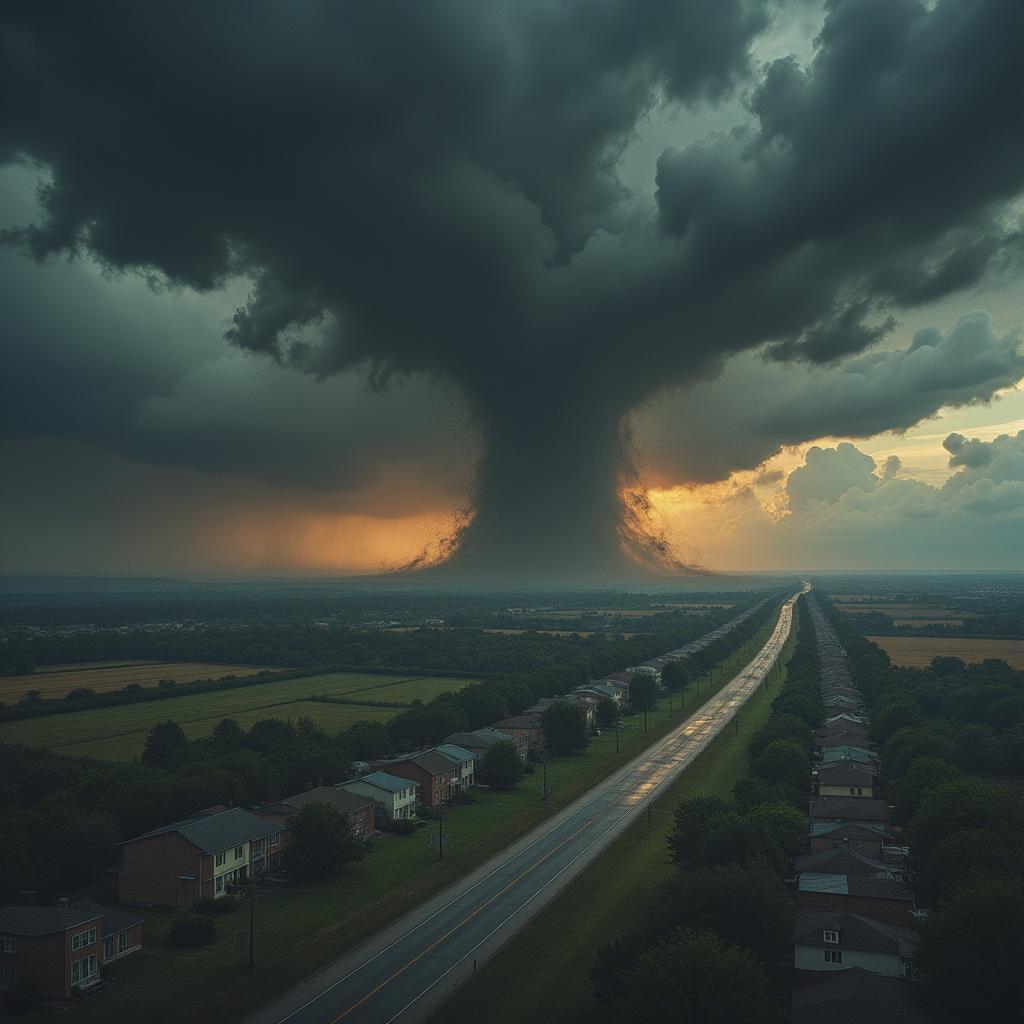
Understanding the Tornado and Wind Threats
The latest updates indicate the presence of a squall line spreading eastward from the southern states, with tornado and severe thunderstorm watches already in effect. This weather event is reminiscent of previous severe weather outbreaks that have caused considerable damage across similar regions.
According to reports, earlier this week, parts of eastern and southern Oklahoma and North Texas experienced significant weather events that resulted in damaged structures. In Dallas, wind gusts reached a staggering 78 mph, while 87 mph were recorded near Fittstown, Oklahoma. This highlights the capacity of these storms to unleash violent wind capabilities.
Current Radar and Warnings
As conditions continue to develop, NOAA’s Storm Prediction Center has identified critical areas ranging from eastern Texas and Oklahoma to the lower Mississippi Valley, Alabama, and western Georgia as being at heightened risk for severe thunderstorms.
The squall line’s trajectory will indeed pose serious threats; however, isolated supercells could form ahead of it, which may amplify the risk of tornadoes. The regions appearing in red on forecast maps indicate where damaging winds and tornadoes are most likely, particularly in southern Arkansas, northern Louisiana, central and southern Mississippi, southwest Alabama, and parts of the Florida Panhandle.
Heavy Rainfall and Flooding Risks
With this storm system, heavy rainfall is another concern, though localized flash flooding is expected. The storm may produce rains that lead to brief flash floods but are not likely to result in widespread inundation.
As we move toward Wednesday, the storms are projected to shift further eastward, affecting Delaware and Maryland down to northern Florida. Major cities such as Charleston, South Carolina, Raleigh, North Carolina, Richmond, Virginia, and Washington, D.C., should remain on high alert as they could face damaging winds and even a few tornadoes.
Preparing for Severe Weather
It is essential for communities and individuals to have a robust severe weather safety plan in place. This includes ensuring multiple channels for receiving National Weather Service alerts and determining safe shelter locations in case of a tornado or severe thunderstorm warning.
If you’ve been following this storm’s trajectory, it’s advisable to stay updated by checking weather reports frequently. Monitoring platforms like Weather.com and apps, such as The Weather Channel app, can provide real-time updates and alerts.
A Historical Perspective
This storm system is part of a broader pattern of extreme weather anomalies that have occurred more frequently over the past few years. Historical data indicates that climate change has intensified severe weather events, leading to conditions that favor the production of severe thunderstorms and tornadoes.
For example, last year’s severe weather season brought devastating tornadoes that disrupted many communities across the U.S. Understanding the potential traits of these storms helps in creating contingency plans to mitigate damage and safeguard lives.
What to Expect Wednesday
By Wednesday, the severe weather threat persists, especially across the eastern coast. Wind gusts may reach dangerous levels in the Northeast, leading to further disruptions. Residents are urged to be vigilant about emerging weather updates and warnings throughout the day.
As we brace for these intense conditions, it’s crucial to prioritize safety and preparedness in the face of potential tornado and wind damages. Extreme weather not only affects homes and infrastructure but also poses real risks to safety.
Stay tuned for further updates as the storm traverses through the eastern part of the United States, and remain aware of your surroundings and the weather conditions that could impact your area.
For more detailed information, visit the Weather Channel.
To learn about the disclaimer of liability for the content of this website, click here